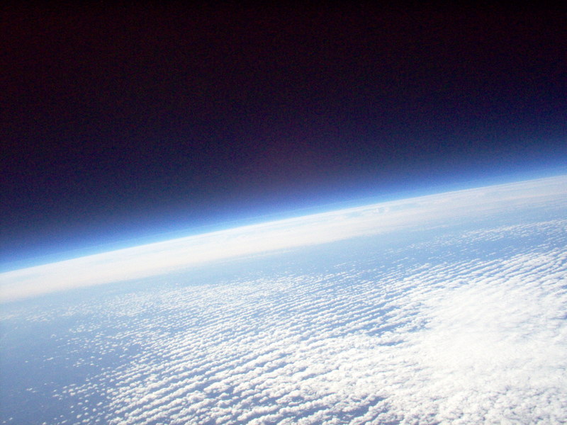
 During the night on our flight to Dusseldorf, we hit some rough air and the pilot took us up to 39,000 feet. When the sun came up, i opened the window and saw the curve of the earth, bending down in front of us and again behind us. . It was a gentle curve, not like the beachball rotundity that the astronauts see, but a curve nonetheless. I'm not sure I'd ever been up that high. It made me feel a long way from the ground. (the picture is one from 90,000 ft up, not mine).
As a map fanatic, I like to know where we are while I'm flying. It gives a (fictitious) sense of groundedness, of connection to the real earth, while my suspended life consists of this bizarrre cigar-shaped polystyrene cabin shared with a few hundred others including the screaming 2-year-old in front of me.
Earlier in the flight, while we were still over North America and the sun had not set, something went wrong with the plane's entertainment video system. That meant not only that I couldn't watch episodes of Friday Night Lights, but also that the cool flight map that some flights give you was not working. So, with a lot of cloud cover and only intermittent views of the ground, it was harder than usual to figure out where we were.
At one point, we were launching out over lots of water, with a curving peninsula to the south of us that I thought might be the Gaspé just where the St. Lawrence River meets the North Atlantic. Then the clouds hit again; an hour or so, later we saw ground again that was obviously still the farmland of Canada. The water had been, I'm guessing, Georgian Bay, off Lake Huron. Oops.
Knowing where you are on the map is nice, but the accuracy of that "knowing" really doesn't make any difference, except for the folks in the cockpit.
Eventually, the mapping system was working again, as we ate breakfast over the Irish Sea and started sloping southeast across England. I watched it of course, while also hunting for breaks in the clouds to corroborate what the map was telling me about where we were (as if it could be wrong!).
 I love that instant mapping screen. For one thing, I love the stolid repetitiveness of its numbers: distance to destination, 3,204 miles; a few minutes later, distance to destination, 3,125 miles, our inevitable progress (we hope) plotted in sequential announcements, like the daily sextant readings in a China clipper's log book.
 I also love the way the screen flips through various views, from local (maybe 500 miles) to regional (maybe 2,000 miles) to global (our plane, a tiny dot, on its trajectory across a screen that flattens the earth, a great ice cap on top and bottom, continents and oceans striping vertically across, and the big waveform that indicates night finally running away from us at 1,000 miles an hour or so.

Yes, I know where we are! And yes, apparently so does the pilot!
No comments:
Post a Comment